Neighbourhood Planning
Building New Neighbourhoods
Great neighbourhoods contribute to the prosperity of our city, attracting new people, new business and creating vitality while allowing the city to respond to change over time. Great neighbourhoods are the foundation of a great city. The City of Red Deer's Neighbourhood Planning & Design Standards 2013 (pdf) outlines guiding principles, a set of standards and a process for building great neighbourhoods. The Neighbourhood Planning and Design Standards Appendix (pdf) provides additional information and guidance for preparation and submission of a Neighbourhood Area Structure Plan.
The design standards are not specific to any geographic area of the city and should be used in the preparation of neighbourhood area structure plans, infill developments and even considered during individual site design applications.
Neighbourhood Area Structure Plans
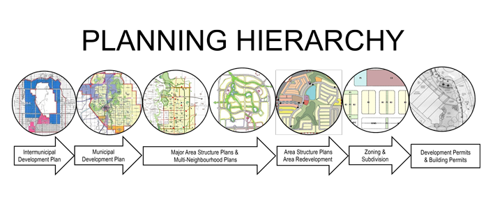
A Neighbourhood Area Structure Plan (NASP) is a required land use concept plan that must be prepared by a developer for any large undeveloped parcel of land, generally one quarter section (160 acres) in size or larger.
The NASP requires City Council approval. To facilitate subsequent zoning and subdivision decisions, these plans must conform to any applicable major area structure plan and provide a detailed level of planning information including, but not limited to:
- land uses
- all road and lane locations
- types of residential/commercial/industrial development
- number of dwelling units
- community trail and park development
- utility infrastructure and storm water management facilities
- density
- Plans & Guidelines Map (2019) (pdf)
Current NASPs
- Anders on the Lake May 2003 (pdf)
- Aspen Ridge Aug 2021 (pdf)
- Bower Woods 2025 (pdf)
- Clearview North 2009 (pdf)
- Coventry 2018 (pdf)
- Deer Park Davenport 2021 (pdf)
- Deer Park Devonshire 2002 (pdf)
- Emerson NASP (pdf)
- Evergreen NASP 2014 (pdf)
- Garden Heights 2009 (pdf)
- Glendale NW 2011 (pdf)
- Hazlett Lake (2018) (pdf)
- Highland Green 2006 (pdf)
- Inglewood East 2021 (pdf)
- Inglewood West 2004 (pdf)
- Johnstone Crossing 2006 (pdf)
- Johnstone Park 2007 (pdf)
- Kentwood NE Kingsgate 2023 (pdf)
- Kentwood West 2021 (pdf)
- Lancaster East Lonsdale 2021 (pdf)
- Lancaster South Lancaster Green 2025 (pdf)
- Lancaster Vanier East 2024 (pdf)
- Michener Hill East 2007 (pdf)
- Northeast High Schools and Play Fields ASP (Sept 2, 2014) (pdf)
- Oriole Park West 2007 (pdf)
- Section 13 NW/SW NASP (pdf)
- Southpoint Junction 2009 (pdf)
- Sunnybrook South 2013 (pdf)
- Timber Ridge 2012 (pdf)
- Timberlands North NASP 2013 (pdf)
- Timberlands South 2013 (pdf)
- Timberstone Park NASP 2017 (pdf)
- Vanier Wood NASP 2017 (pdf)
- West Park Extension 2008 (pdf)
For information about Neighbourhood Area Structure Plans contact Planning.
Outline Plans
Outline Plans are non-statutory land use concept plans that were adopted by resolution of Council to guide the subdivision and development within certain neighbourhoods.
Current Outline Plans
- Anders East (Victoria Park) Outline Plan- June 1998 (pdf)
- Clearview Southeast Outline Plan-Nov 1999 (pdf)
- Deer Park (City) Outline Plan- Nov 1983 (pdf)
- Deer Park (Melcor) Outline Plan- Jan 1997 (pdf)
- Kentwood East Outline Plan- May 2021 (pdf)
- Lancaster Meadows Outline Plan - June 1998 (pdf)
- Rosedale Estates Outline Plan- May 2021 (pdf)